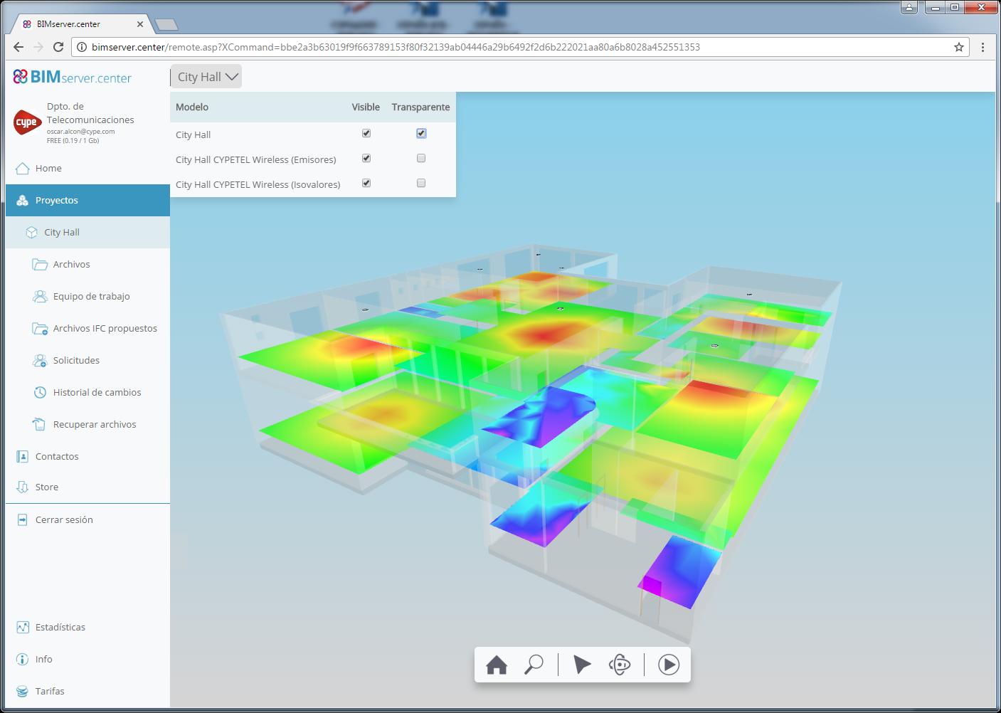
When a project that has been designed using CYPETEL Wireless is exported to the project located in the “BIMserver.center” platform, the IFC file that is generated includes a “GLTF” file with the coverage contour maps in the 3D view. This allows users to view the diagram with the 3D viewer of “BIMserver.center” using the Web version or application for mobile devices (App).
This “GLTF” file is independent to that generated by CYPETEL Wireless with emitters, so each file can be viewed independently.