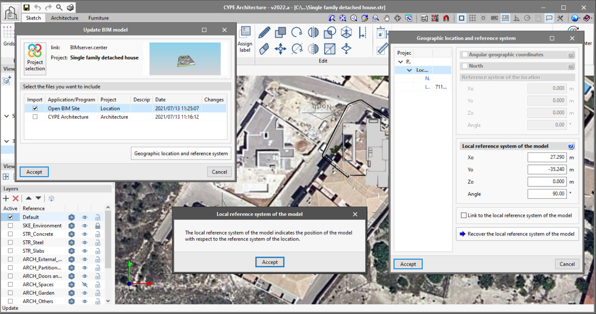
As of version 2022.a, the applications integrated within the Open BIM workflow via the BIMserver.center platform include a tool for managing project reference systems. This option is available from the configuration window displayed during the process of linking or updating the BIM project.
The "Geographic location and reference system" panel displays the reference systems associated to the models that have been previously selected to be incorporated in the project located in the application where the work is being carried out. When a reference system is selected, it will be used as the local coordinate origin of the new model. We can see the following information related to a reference system:
- Angular geographic coordinates
If a location contains a definition of angular geographical coordinates, they will be displayed in this panel. The angular geographic coordinates allow the location of the model to be defined in the real world. This information can be used to calculate the natural lighting or perform the energy analysis of the project. - North
The North direction is defined by the value of the angle relative to the positive Y axis of the project, in the anticlockwise direction. Like the angular geographic coordinates, the orientation of the building can be used to calculate the natural lighting or perform the energy analysis of the project. - Reference system of the location
This indicates the coordinated position of the origin of the project location. Usually, the project location coordinate position is shown in UTM coordinates ("Universal Transverse Mercator"). - Local reference system of the model
The local reference system of the model indicates the position of the model with regard to the reference system of the location. If the "Link to the local reference system of the model" option is checked, the same reference system as the selected model shall be used. Otherwise, a different local reference system to the selected model site can be specified for the new job. The "Recover the local reference system of the model" button allows the coordinates to be filled with the data from the selected model when the "Link to the local reference system of the model" is active.