
Configuring location data
If you select the "Energy simulation" project type, the following option is available in the "Project" section of the main toolbar on the "Building" tab, allowing you to configure the location data:

Location data
When you click on this option, the "Location data" window opens, which provides details of the climate at the location where the building is located.
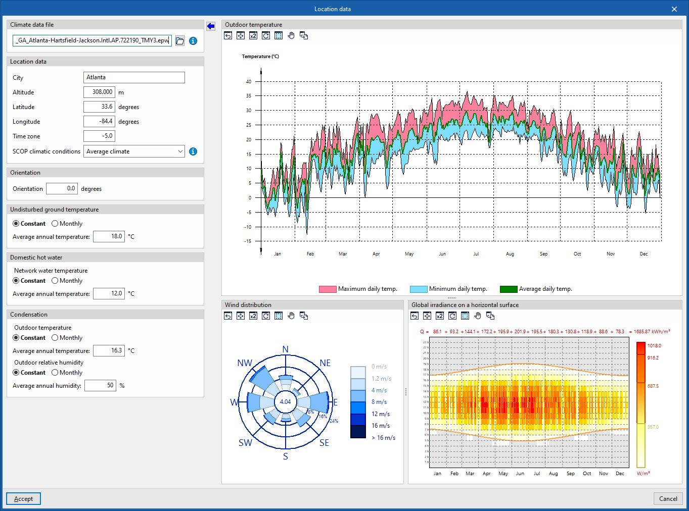
The energy simulation will be carried out using the climate data file indicated in the "Climate data file" section, located in the top-left corner of this panel:
- Climate data file
Specify the location of the climate data file in EPW (EnergyPlus Weather Format) corresponding to the building’s location. Climate data files in .epw format for over 2,100 locations worldwide are available free of charge on the official EnergyPlus™ website (energyplus.net/weather).
The "Import the values from the selected climate data file" wizard lets you enter the information contained in that file into the panel.
The following data can be entered by importing climate files or adjusted at a later stage:
- Location data
- Location, Altitude, Latitude, Longitude, Time zone
This data is for information purposes and is used in the preparation of results reports. In the energy simulation, these parameters are automatically read from the climate data file with the .epw extension. - SCOP climatic conditions (Warm climate / Moderate climate / Cold climate)
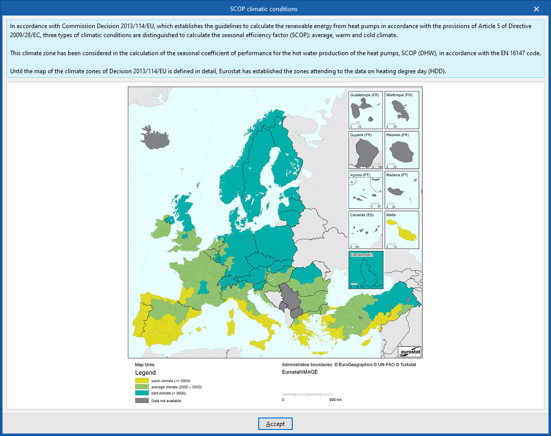
Select the climatic conditions based on the building’s location. On the right, the program provides assistance in selecting the climate corresponding to the region where the project is located, according to Eurostat. This selection influences the calculation of the average seasonal DHW production output (SCOPDHW) for heat pump systems.
- Location, Altitude, Latitude, Longitude, Time zone
- Orientation
Rotate the building. The direction of north is shown in the "View" panel and on the "Drawings" tab by means of the arrow in the bottom left-hand corner. - Undisturbed ground temperature
The ground temperature (unaffected by environmental conditions) is defined as a constant value for the whole year or on a monthly basis. These values are used in the calculation of heat losses to the ground.- Constant (Average annual temperature) / By month (Temperature by month)
- Domestic hot water
The temperature of the mains water is defined, either as a constant value for the whole year or on a monthly basis. These values are used in the calculation of the energy required to produce domestic hot water (DHW).- Constant (Average annual temperature) / By month (Temperature by month)
- Condensation
The outdoor temperature and humidity values to be used for checking for condensation are defined. Constant values can be defined for the whole year or on a monthly basis.- Outdoor temperature
- Constant (Average annual temperature) / By month (Temperature by month)
- Relative external humidity
- Constant (Average annual humidity) / By month (Humidity by month)
- Outdoor temperature
The graphs showing outdoor temperature, wind distribution and solar radiation on the right-hand side of this panel reflect the data from the selected climate data file:
- Outdoor temperature
Daily maximum, daily minimum and daily average temperatures for a given year from the selected climate data file. - Wind distribution
Wind speed in the cardinal and intercardinal directions, based on the selected climate data file. - Global irradiance on a horizontal surface
Global irradiation on a horizontal plane for different times of day and different days in a given year from the selected climate data file.