Customize Consent Preferences

We use cookies to help you navigate efficiently and perform certain functions. You will find detailed information about all cookies under each consent category below.

The cookies that are categorized as "Necessary" are stored on your browser as they are essential for enabling the basic functionalities of the site.... 

Always Active
Strictly necessary cookies are absolutely essential for the website to function properly. These cookies provide the basic functions and security features of the website, anonymously.
Functionality cookies help to carry out certain functions, such as sharing the website content on social media platforms, collecting feedback, and other third-party features.
Performance cookies are used to understand and analyse the key performance indicators of the website, thus helping to provide a better user experience for visitors.

No cookies to display.

Analytics cookies are used to understand how visitors interact with the website. These cookies help provide information on website metrics, such as the number of visitors, bounce rate, traffic source, etc.
Advertisement cookies are used to provide visitors with relevant ads and marketing campaigns. These cookies track visitors across websites and collect information to provide customized ads.

No cookies to display.

Unclassified cookies are cookies that are being analysed and have not yet been assigned a category.

No cookies to display.

Share

Version

Associated programs

Type and calculation of the number of points on a topographic surface

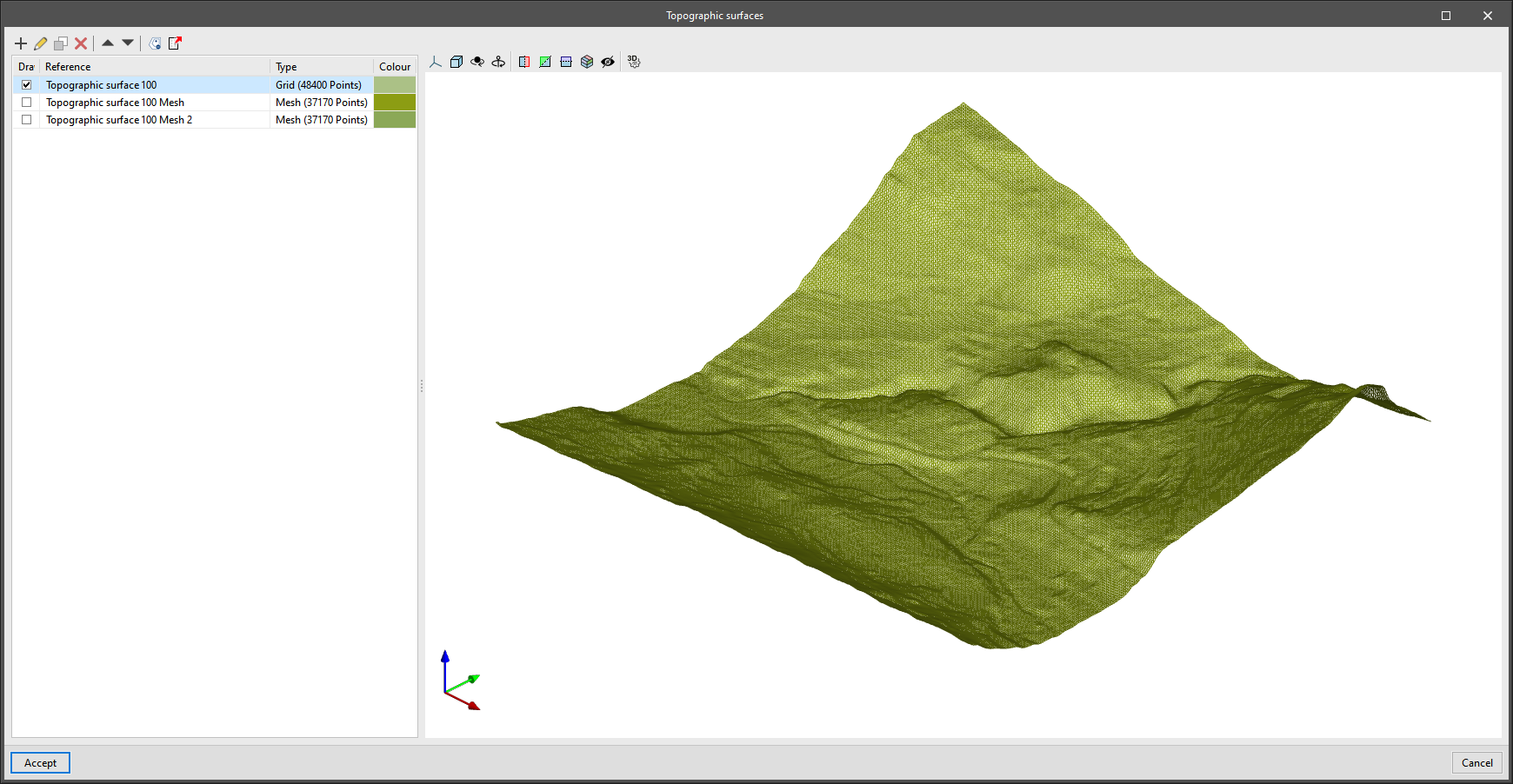
The "Type" column has been added to the project's table of topographic surfaces, available in the application's toolbar. In this new field, users can indicate whether the surface has either a "Mesh" or a "Grid" type definition. A "Grid" type topographic surface is defined by points arranged on the basis of a grid, whereas a "Mesh" type topographic surface is composed of vertices that are arranged without an organised structure. "Grid" type surfaces are more efficient when represented on the drawing area of the program, as the triangulation process has a lower computational cost. However, the points that make up this type of surface cannot be added or edited from Open BIM Site.

Along with the type of the topographic surface, the number of points that define it is also displayed.