As of version 2025.d, Open BIM Site can obtain maps via WMS services from the following data source:
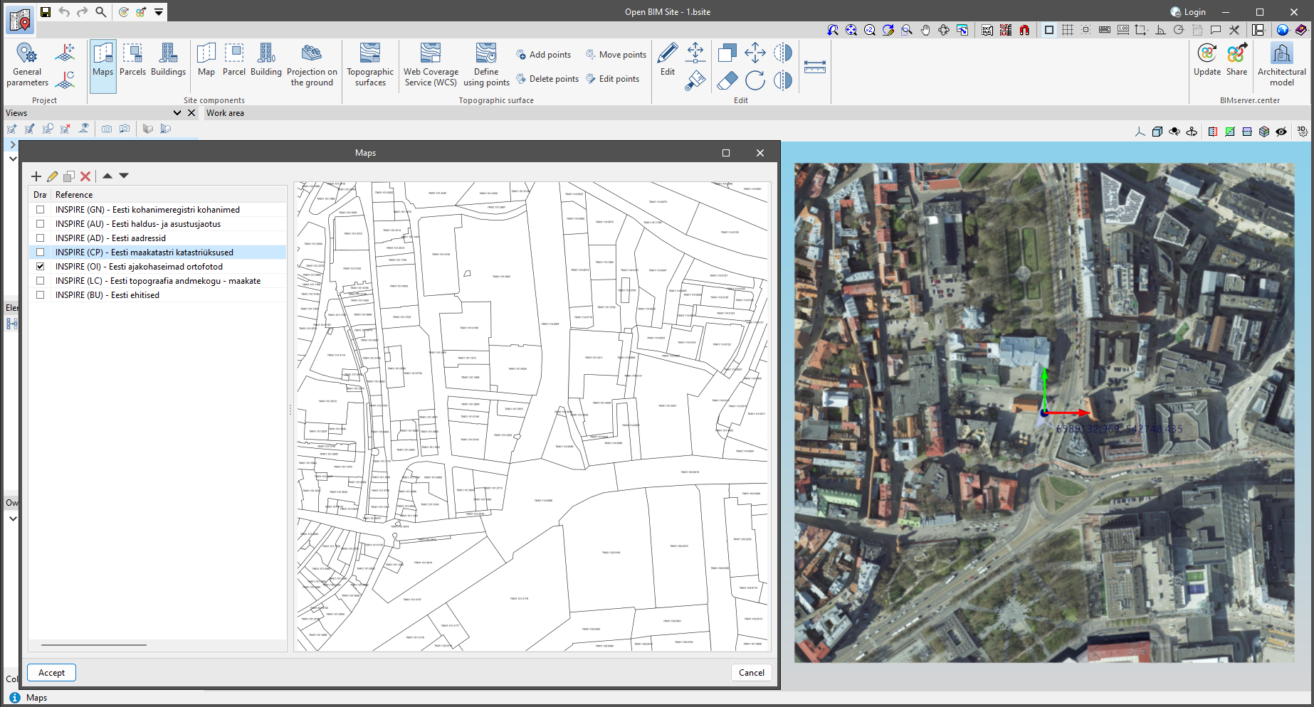
- France
- Géoplateforme - WMS INSPIRE Raster.


As of version 2025.d, Open BIM Site can obtain maps via WMS services from the following data source:
As of version 2025.d, when clicking the "Share" option of the apps (before starting the generation of the contribution files), a check is made to ensure that the user is part of the BIMserver.center project team. If the user does not have the appropriate permissions, a warning message is displayed. This prevents the generation of unnecessary files when the user does not have editing rights.

As of version 2025.d, the "Project selection" window in the apps connected to BIMserver.center incorporates a new notification system to inform users about the latest new features on the platform.
This space displays relevant messages about new features, enhancements and recommendations related to BIMserver.center. In addition, direct links to documents, tutorials and additional resources will be included to facilitate the adoption of these new features.

In version 2025.c, new options have been added to the "Help" menu of all CYPE apps, providing direct links to key resources on the CYPE website. These options make it easier to access to useful information and Technical Support, improving the overall experience of using the program.
The new options are the following:
These new additions make it easier to access information and provide the necessary support to improve the users' experience with the apps and to encourage professional development.
In version 2025.c, the preview for moving dockable windows within the apps has been improved. Now, when dragging a dockable window, the preview of its docked position is displayed transparently, allowing a clearer view of the underlying work area.
This new feature makes it easy to find the optimal location for each dockable window without obstructing important elements or losing sight of relevant project information. It also provides a smoother and more modern visual experience, aligned with best practices in user interface design.
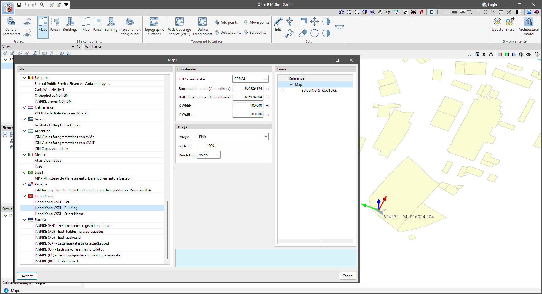
As of version 2025.c, Open BIM Site can obtain maps through these new WMS services from the following data sources:
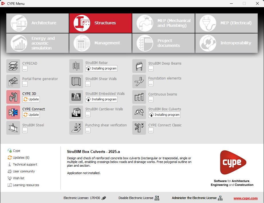
The following modifications have been made to the apps available in the CYPE Menu:
New apps
Deleted apps
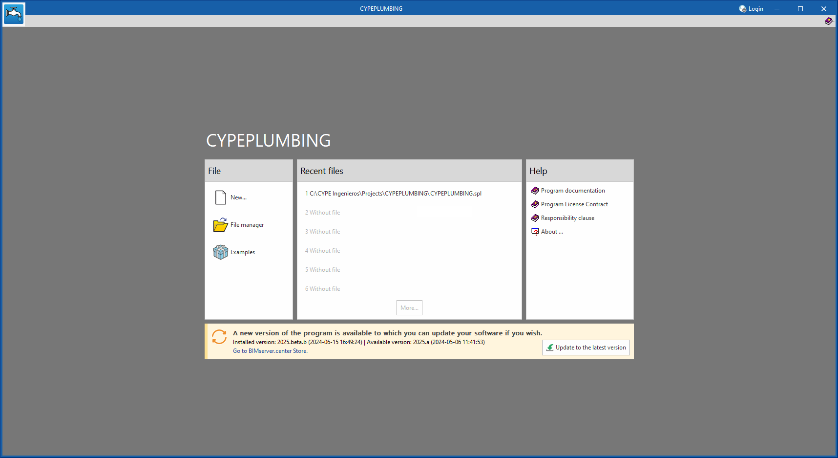
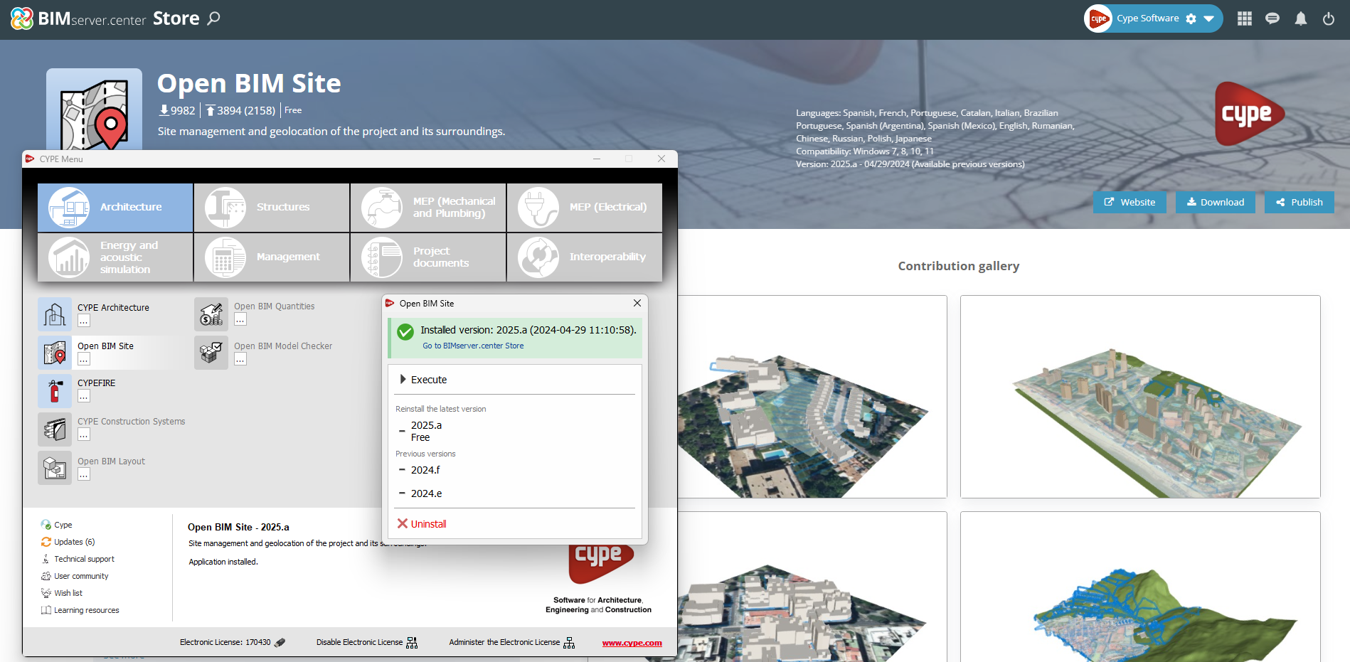
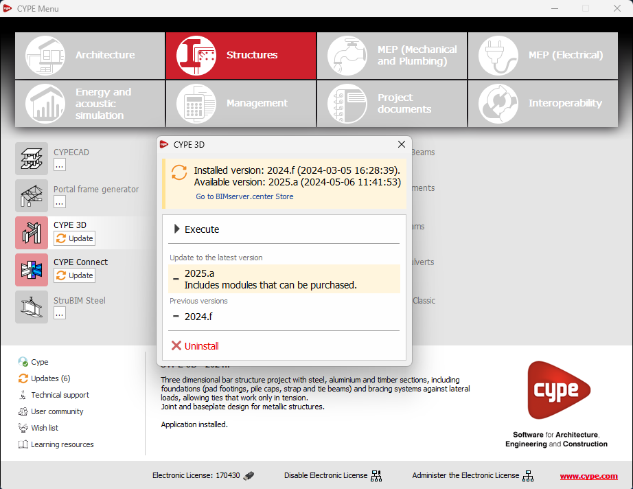
As of version 2025.b, applications now display a warning message in their initial window when a new update is available. This message provides information about the "installed version" and the "available version", together with a direct link to the Store page of the BIMserver.center web platform.
Clicking on the “Upgrade to the latest version” button automatically starts the download and installation process of the application. This feature ensures that the most current version of the program is always being used, thus benefiting from the latest improvements.
This method replaces the automatic notification and update process of a new version in the BIMserver.center programs available in previous versions.
In the configuration panel for each application, a direct link to its page in the BIMserver.center web store has been included.
By clicking on the “Go to BIMserver.center Store” button, users are redirected directly to the corresponding page in the Store, where they can learn more about the application, view its features, read reviews from other users and see examples of real contributions.
This feature provides easy access to additional resources and support, enhancing the user experience by providing quick and easy access to all relevant information about the applications.
An information message has been incorporated into the installation button of the applications so that, before proceeding with the installation, users can identify which applications are free to use (free of charge) and which require licensing permissions (including paid modules).
This enhancement improves the user experience by providing clarity and transparency on the options available to the user based on their license model.
In the new 2025.b version of CYPE Menu, the background installation feature has been added. Users can now continue working on other tasks while applications are automatically installed in the background.
During the background installation process, the “Installing program” message is displayed next to the applications button in the main CYPE Menu window. Once completed, the message disappears and the application can be run.
This feature is designed to make applications easier to use and manage, improving productivity and the overall experience by minimising waiting time and interruptions during the installation of new applications or upgrades.