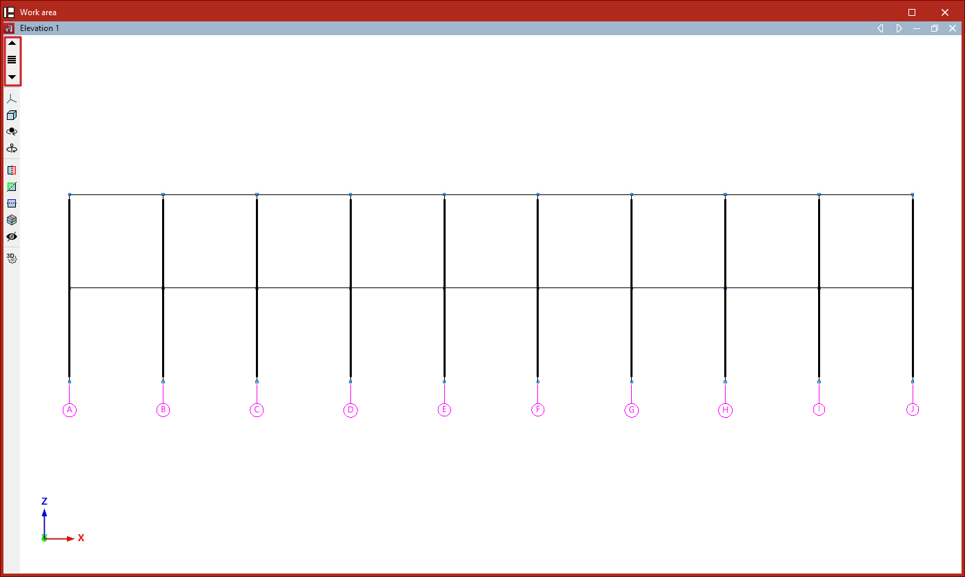
Elevation views parallel to grid lines
Elevation views are 2D views that show the elements belonging to the elevation, as well as those arriving at or departing from it. Elements added in the elevation views will be contained within the view plane.
Creating elevation views
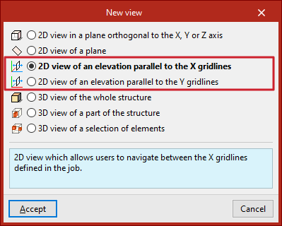
If a grid is defined in the model from the "Geometry" tab, the program will allow the creation of elevation views.
To do this, from the "Window" tab, select the "Open new" option.
Here, you can create a "2D view of an elevation parallel to X gridlines" or a "2D view of an elevation parallel to Y gridlines" and click "Accept".
Navigating between elevation views
Once the elevation views have been created, you can move from one elevation to another using the "Move forward one line" or "Move back one line" buttons located on the toolbar on the left-hand side of the window.
You can also click on the "Elevations" option located between these buttons to select and display a specific elevation.