Origin of the site reference system

General parameter settings
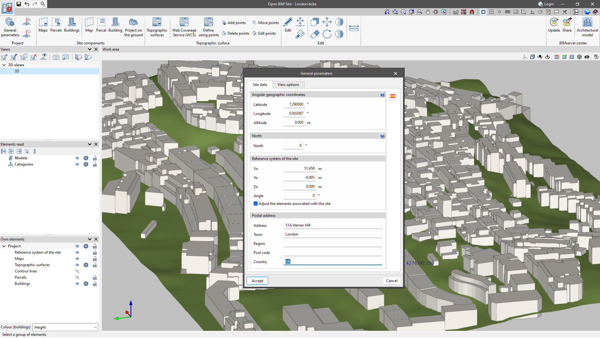
In the "Project" group there is a "General parameters" section, where the geographical location and site data can be entered.
- Angular geographic coordinates
In this section, users can enter the latitude, longitude and altitude of the site. The angular geographic coordinates allow the real location of the model to be defined. This information can be used for natural lighting calculations or the project's energy analysis. - North
The "North" direction is defined by the value of the angle relative to the positive y-axis of the project, in a counter-clockwise direction. The building orientation can be used for natural lighting calculations or the project's energy analysis. - Reference system of the site
Indicates the coordinate position of the project site. The location of the site coordinate system is usually expressed in UTM (Universal Transverse Mercator) coordinates. - Postal address
This section provides the address details of the site.
Note:
When the "Adjust the elements associated with the site" check box is deactivated, if the values of the origin of the site reference system are modified, the elements of the model (topographic surfaces, maps, plots, etc.) will not be adjusted to this modification. However, if the check box is activated, when editing the values of the origin of the site reference system, the elements that make up the site model shall be moved to adapt to the modification.
Moving and rotating the origin of the site reference system
With these tools, users can graphically redefine the origin and orientation of the site's reference system.
- Move the reference system of the site
Allows a new position for the origin of the site reference system to be defined on the work area. - Rotate the reference system of the site
Allows users to specify an angle on the work area to rotate the site reference system.
More information:
A more detailed explanation of how to move and rotate the site reference system in Open BIM Site is provided in the Frequently Asked Questions (FAQ).