Entering site components
Entering maps

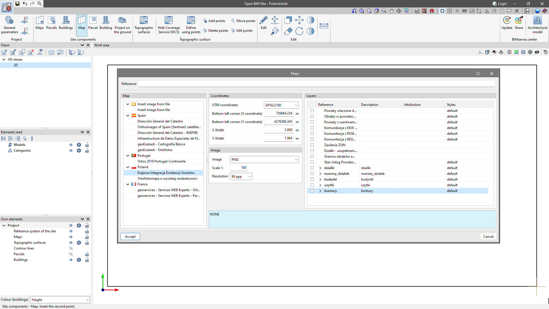
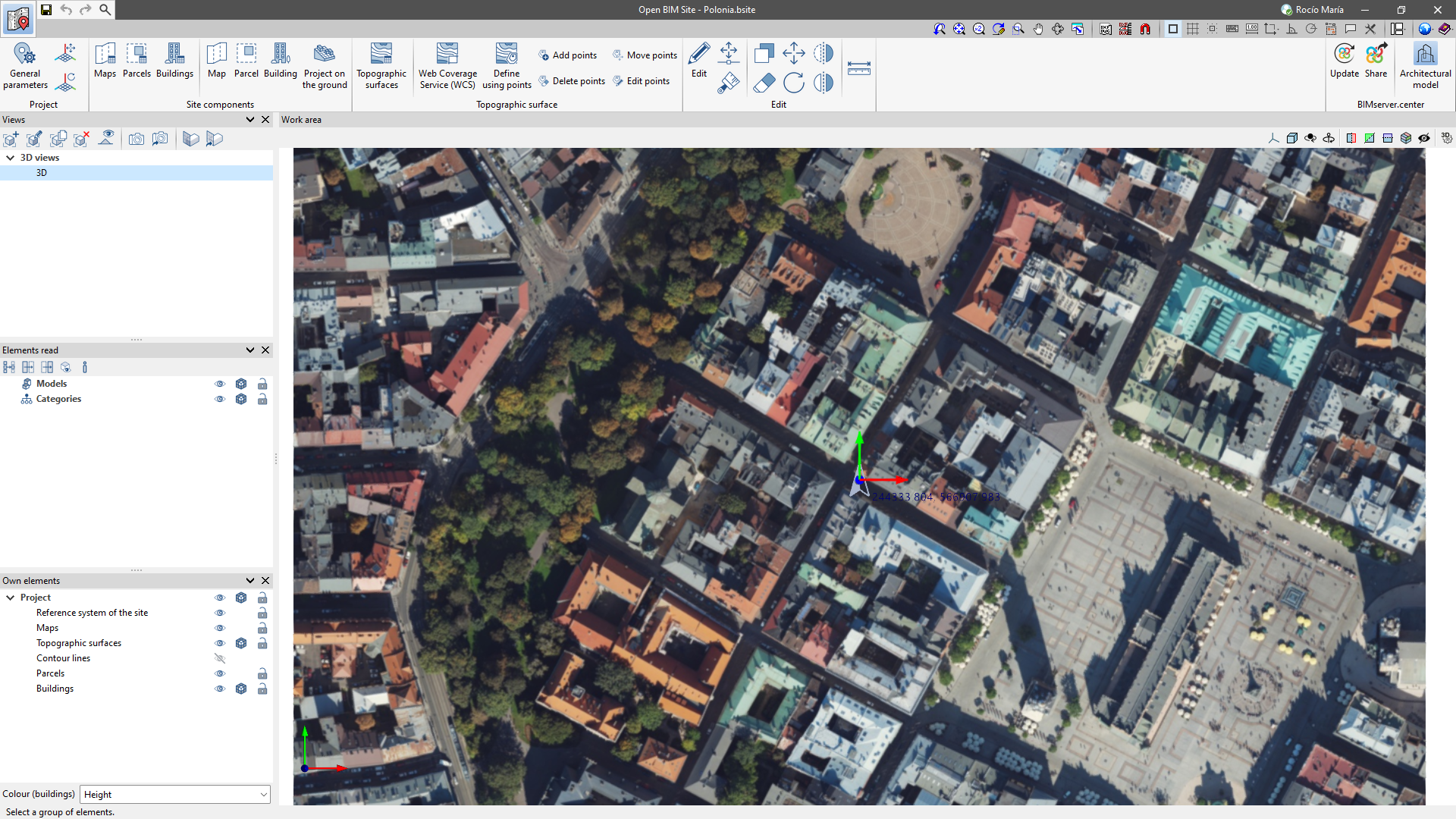
To insert maps, simply make a selection in the "Work area". Subsequently, the "Maps" window will appear, where it is possible to select different data sources to obtain the maps. The desired map can be configured in the following sections.
- Coordinates
Specifies the section of the space covered by the WMS service to be imported.
- Image
Allows users to configure the properties of the image to be downloaded.
- Layers
Some WMS services allow users to configure the layers of information that are added to the image.
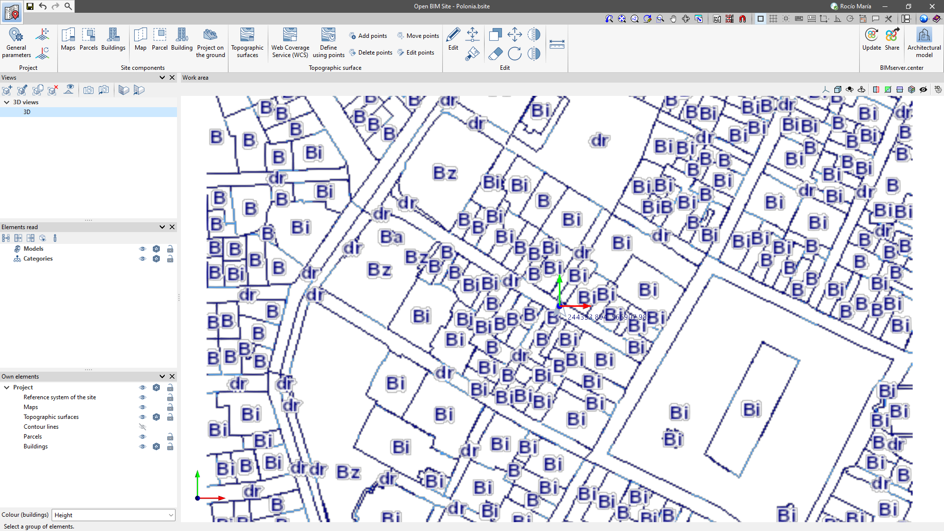
Entering parcels and buildings

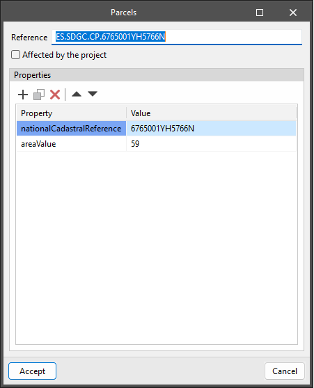
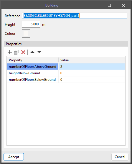
In Open BIM Site, users can define parcels by entering 3D contours. A parcel can contain buildings, which are defined not only by contour but also by height.
Both parcels and buildings can have associated properties for further information.
Furthermore, users can also specify on which parcels of the site model the project is to be implemented. In the "Parcel" configuration panel, there is the "Affected by project" option. When this option is activated, the outline of the parcel will be represented in a different colour in the work area.
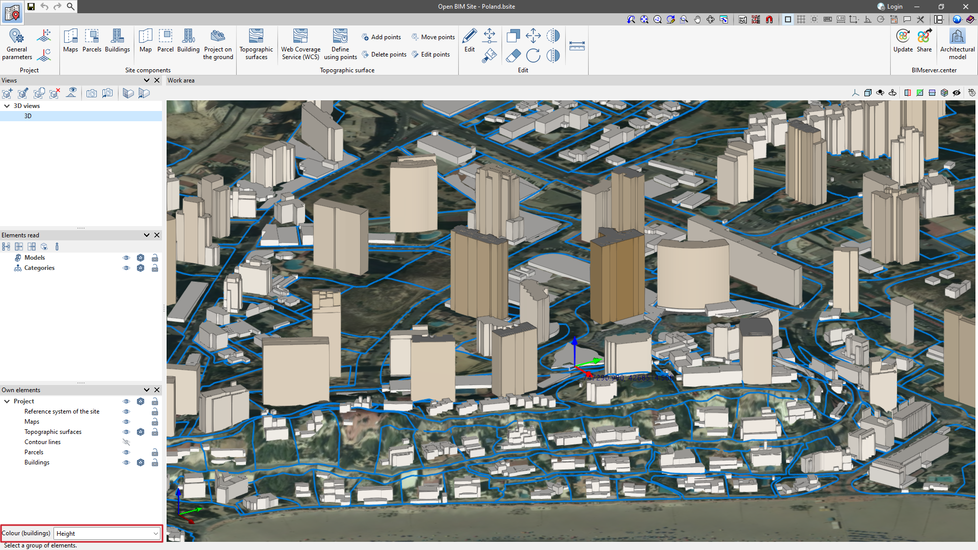
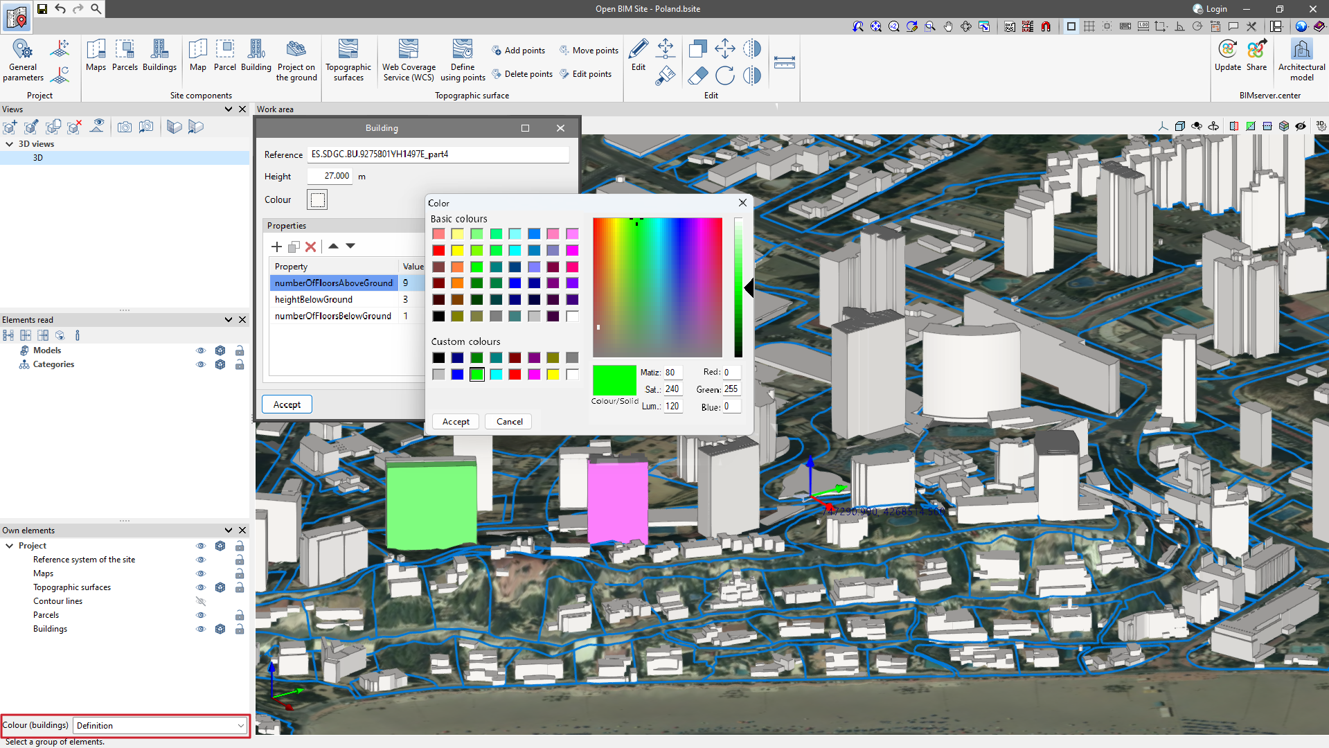
The buildings of the site model can be assigned a colour. The "Colour" parameter can be found in the "Building" configuration panel. Additionally, from the drop-down menu "Colour (buildings)" in the sidebar on the left-hand side of the drawing space, users can change how the colour of the buildings is displayed. This menu has the following options:
- Height
With this option, buildings are displayed in different colours depending on their height. - Definition
With this option, the buildings are displayed in the colour defined in their configuration panel.