Defining location data
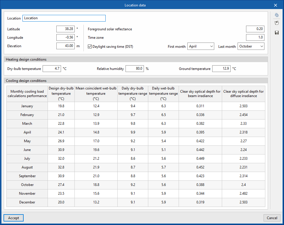
Defining the project location data is carried out with the "Location data" option in the "Project" group in the upper toolbar of the "Analysis" tab, which in turn is located in the "Thermal loads" tab at the bottom.

The data available for configuration is as follows:
- Location
- Latitude
- Longitude
- Elevation
- Foreground solar reflectance
- Time zone
- Daylight saving time (DST) (optional)
- First month
- Last month
- Heating design conditions
Sets the data required for the analysis of heating loads:- Dry-bulb temperature
- Relative humidity
- Ground temperature
- Cooling design conditions
Consults the data necessary for the analysis of cooling loads per month. By clicking on any cell in the table, the value of each magnitude for each month can be modified:- Design dry-bulb temperature
- Mean coincident wet-bulb temperature
- Daily dry-bulb temperature range
- Daily wet-bulb temperature range
- Clear sky optical depth for beam irradiance
- Clear sky optical depth for diffuse irradiance
Automatic data import
The "Import" option at the top right of the "Location data" window allows the automatic import of data from different climate databases. These include the following:
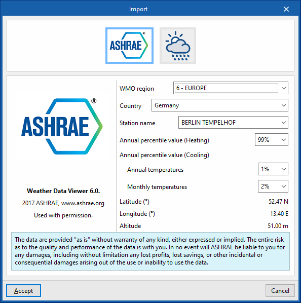
ASHRAE Weather Data Viewer 6.0
The climate data required for the analysis can be imported from ASHRAE's Weather Data Viewer 6.0 climate database, with 8118 stations located all over the world. Solar radiation data are calculated from ASHRAE's Clear-sky Solar Radiation model.
- WMO region
- Country
- Station name
- Annual percentile value (Heating) (99.6% / 99%)
- Annual percentile value (Cooling)
- Annual temperatures (0.4% / 1% / 2%)
- Monthly temperatures (0.4% / 2% / 5%)
- Latitude
- Longitude
- Altitude
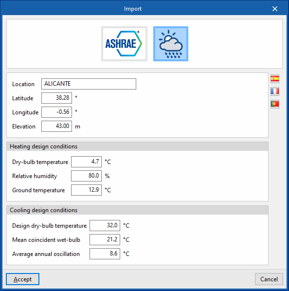
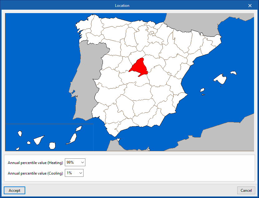
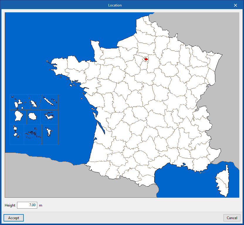
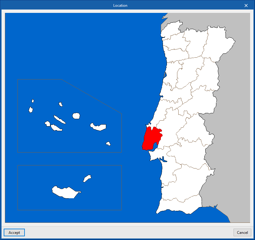
Importing data for Spain, France and Portugal
The origin of this data can be found in different reference standards for the countries mentioned. By clicking on the buttons with the flag symbols on the right-hand side, the exact location of the project in each of these countries can be defined. When accepted, the following data will be filled in:
- Location
- Latitude
- Longitude
- Altitude
- Heating design conditions
- Dry-bulb temperature
- Relative temperature
- Ground temperature
- Cooling design conditions
- Design dry-bulb temperature
- Mean coincident wet-bulb
- Average annual oscillation


