Reading point clouds
IFC Builder can read a representation both in 3D and on plan from point cloud files (*.pts; *.ptx; *.txt; *.xyz), which can be used as a support to model reality quickly and accurately from a BIM environment.
A point cloud is the result of one or more 3D laser scans consisting of a set of vertices in a three-dimensional coordinate system, usually defined by "x", "y" and "z" coordinates, and sometimes incorporating additional data such as colour using RGB values.

The "Point cloud" menu in the main toolbar of the program's general interface contains the following options:
- Files
- Visibility
Files
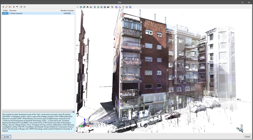
Allows users to select PTS, PTX, TXT or XYZ point cloud files at their location on disk and load them into the program, defining the following information:
- File name
- Show in monochrome (optional)
The loaded point cloud files are displayed in a table with the following parameters:
- Visible
- File name
- Number of points
As added tools, the point cloud can be moved and rotated.
Visibility
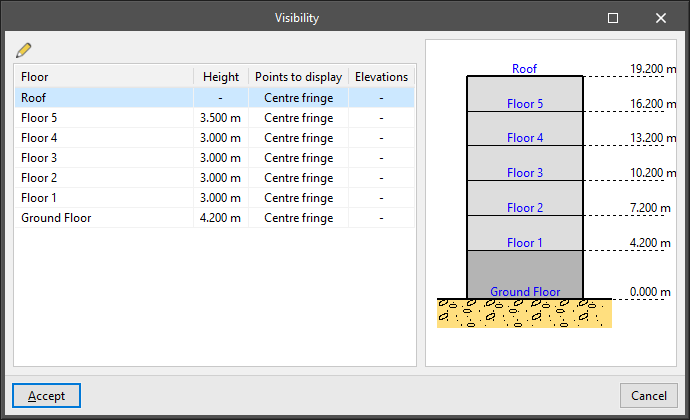
Manages the visibility of the points in the point cloud files on the different floors of the building. The following information is shown in the table:
- Floor
- Height
- Points to display (All points / Centre fringe / Height range)
- Elevations (only for "Height range")
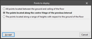
If each floor is edited, the "Points to display" are selected. These points can be:
- All points located between the ground and ceiling of the floor
- The points located along the centre fringe of the previous interval
- The points located along a range of heights with respect to the ground of the floor
- Initial height
- Final height
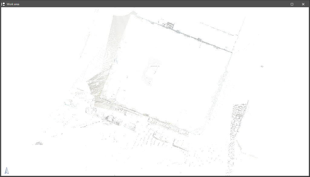
In this way, the visible points of the point cloud can be used as a visual reference when entering the elements of the model floor by floor.
The 3DCONS project aims to bring 3D printing technologies to the construction industry, both in the field of new construction and in the renovation and restoration of cultural heritage, using point cloud technologies for the reading of existing buildings.

