Topography is a technique that describes and delineates the surface of a piece of land in detail. Thanks to this technique, the land's elevation outlines can be measured and recorded, and any changes to the ground can be shown on a map or in a 3D representation. Knowing where a building or construction project is to be carried out is essential for ensuring its successful execution. In fact, most countries require a topographical survey to be submitted via competent bodies in order for the work to be carried out.
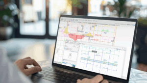
To make professionals' work easier and to make projects more efficient and complete, CYPE has Open BIM Site, a free program that allows professionals to define the initial conditions and location of a project. With this tool, users can establish the geographical location of the models, manage different types of maps, enter topographic surfaces and add elements specific to the site, such as parcels and buildings.
This geographical information provides specialists with a greater decision-making capacity when it comes to adopting site alternatives for their client's projects. Furthermore, Open BIM Site supports the specification of site conditions for construction projects all over the world.
How can Open BIM Site users enter a topographic surface in their projects? Let's find out.
From a points file
Open BIM Site users can define a topographic surface via a points file from other applications. Files that can be read are Esri ASCII format files (ARC/INFO) and comma-separated values files (CSV or TXT).
Entering topographic points
Open BIM Site allows users to enter a topographic surface by placing topographic points on the work area. To do this, the "Define using points" button has been added to the "Topographic surface" group. Once entered, the application automatically generates the ground and adds it to the list of topographic surfaces in the project.
The program can also be used to modify points that make up the topographic surfaces of an existing project. This way, technicians can vary the elevation of one or more points and customise the project based on its needs.
This option gives users more freedom as they are not dependent on cadastral data, for example, to be able to direct the entire management of the land and design spaces such as the perimeter of the parcel or the space for a swimming pool.
Direct database connection
Open BIM Site comes with a connection to official bodies for downloading official information related to site conditions. In Spain, the program is linked to the services of the Spanish cadastre web service “Sede Electrónica del Catastro” and the Spanish infrastructure “Instituto Geográfico Nacional”, sources from which topographic data, plots, buildings and maps can be downloaded.
From the Spanish cadastre web service “Sede Electrónica del Catastro”, all properties that match the search criteria (Cadastral reference-Street/Number) can be found, and spatially referenced maps can also be imported.
The Spanish infrastructure “Instituto Geográfico Nacional” provides digital terrain models from airborne LiDAR sensors of the PNOA-LiDAR project of the Spanish National Geographic Institute “Sistema Cartográfico Nacional”. To download this information, users must enter the property cadastral reference or the address.
Also, the first foreign link has been made in Portugal with the Portuguese infrastructure "Direção-Geral do Território. Divisão de Informação Geográfica" where technicians can import orthoimages of the territory.
Incorporating maps and adapting them to topographic surfaces
Within the direct connection to databases, if the project is geolocated and its location is within the context contemplated by the connected databases, the designer can also download different maps that can also be adapted to the geometry of the topography to further enhance the project.
The different layers of information available in the program include:
- Cadastral data related to the surroundings of the building: parcels, sub-parcels, industrial estates, and blocks.
- Cartography linear features, communication routes, administrative boundaries, coastline, cartographic labelling.
- Orthoimage coverage.
In these cases, the option for accessing Web Map Service (WMS) services, defined by the Open Geospatial Consortium (OGC), and producing spatially referenced data maps dynamically from geographic information is enabled.
Duplicating and modifying an existing surface
One of the main advantages that the program offers to users is the possibility to duplicate and edit the points of an existing surface. This option is particularly useful in situations where the initial topographic conditions of the project are not favourable and earthworks are necessary in order to adjust the topography.
In these cases, the designer can duplicate the surface obtained by any of the aforementioned methods and modify the points that interfere with the project by simulating the final conditions that are expected to be achieved in the completed project.
Different colours can be associated with each topographic surface, contour lines can be generated automatically and the connection of the topographic model with Open BIM Layout increases the options when planning the earthworks project to be carried out.