Update history​​

Open BIM Site

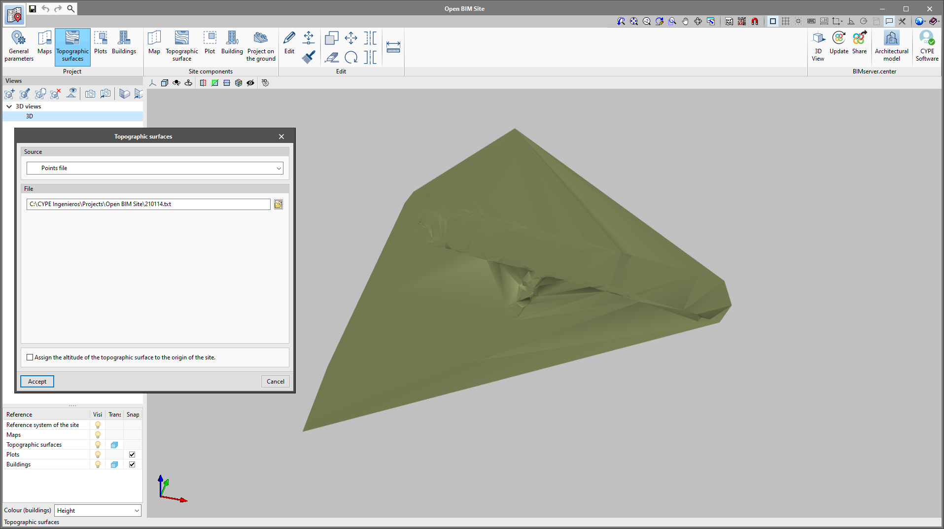
As of version 2022.c, Open BIM Site allows points files to be imported for describing a topographic surface. To do this, the "Points file" option has been added as a possible data source in the definition panel of a topographic surface.

In order for a point file to be interpreted correctly by the application, it must meet the following requirements:

  • It must have a ".csv" or ".txt" extension and the parameters must be separated by commas (",").
  • Each line in the file must be a point on the topographic surface.
  • The first three fields of a line in the file must correspond to the x, y and z coordinates of the point.


The "Map" and "Topographic surface" options have been added to the "Site components" group in the application’s toolbar. Thanks to these new buttons, maps and topographical surfaces from WMS and WCS web services can now be entered directly onto the drawing area. To do this, users must specify with the mouse pointer the two points corresponding to the opposite corners of the rectangle establishing the map section.

It is now possible to indicate on which plots of the site model the project will be carried out. To do this, an option has been included in the plot definition panel with the caption "Affected by the project". When marking this option, the plot outline will be coloured in a different colour from the work area and this information will be exported into the site model for the project that the job is connected to on the BIMserver.center platform.

As of version 2022.c of Open BIM Site, the Web Map Service of the Portuguese organisation "Direção-Geral do Território. Divisão de Informação Geográfica" can be accessed.

The "Ortos 2018 Portugal-Continent" option has been added to the "Maps" menu available in the application’s toolbar. According to the performance of the WMS service, the following coordinate systems can be used to obtain the map section that will be inserted in the work area:

  • ETRS89 / Portugal TM06
  • WGS84 / Pseudo-Mercator

It is now possible to control the visibility of the axes representing the site coordinate origin. This element has been added to the viewing options that appear on the side menu of options on the left-hand side of the drawing area.

As of version 2022.b, the characteristics of buildings and plots will be exported to the 3D viewing file in gLTF format, used for displaying the model both in the web viewer of the BIMserver.center platform and in the rest of desktop and mobile applications. This way, information can be consulted by the members of the Open BIM project work team.

The "Match" tool has been added to the "Edit" group of the application toolbar. With this option, the characteristics of a building can be assigned to others on the same building site. Pressing the button displays a selection panel that allows the user to indicate which of the following data they wish to copy:

  • Height
  • Properties
  • Colour

As of version 2022.b, colours can be assigned to buildings in the site model. To do this, the "Colour" parameter has been added to the building configuration panel. Additionally, the "Colour (buildings)" dropdown menu has been added to the side menu on the left-hand side of the drawing space that allows users to control the way in which the colour of the buildings is displayed. This menu contains the following options:

  • Height
    This is the way of assigning colours to buildings that was used in previous versions. With this option, the buildings are displayed in different colours depending on their height.
  • Definition
    With this option, the buildings are displayed with the colour defined in their configuration panel.

As of version 2022.b, applications with 3D drawing surroundings allow a viewing volume to be defined from the geometric envelope of the scene content. The arrows allow the viewing volume to be adjusted by moving their faces and the arches allow the viewing volume to be adjusted by means of 6 clips planes.

"Open BIM Site" is a free application for defining the initial conditions of a project site. With this tool, users can establish the geographical site of the models, manage different types of maps, enter topographic surfaces and add site-specific elements such as plots and buildings.

This application is integrated into the Open BIM workflow via the BIMserver.center platform.

"Open BIM Site" is an application with an international scope as it allows the site conditions of a construction project anywhere in the world to be specified. However, for projects located in Spain, the application includes a connection to two Spanish web services: the cadastre (Sede Electrónica del Catastro) and the Geographical Institute (Instituto Geográfico Nacional) in order to enter site data more easily, as well as obtaining maps and topographic surfaces.

More information.